 |
Aerial photos: North Antrim (IR01-04)

|
 |
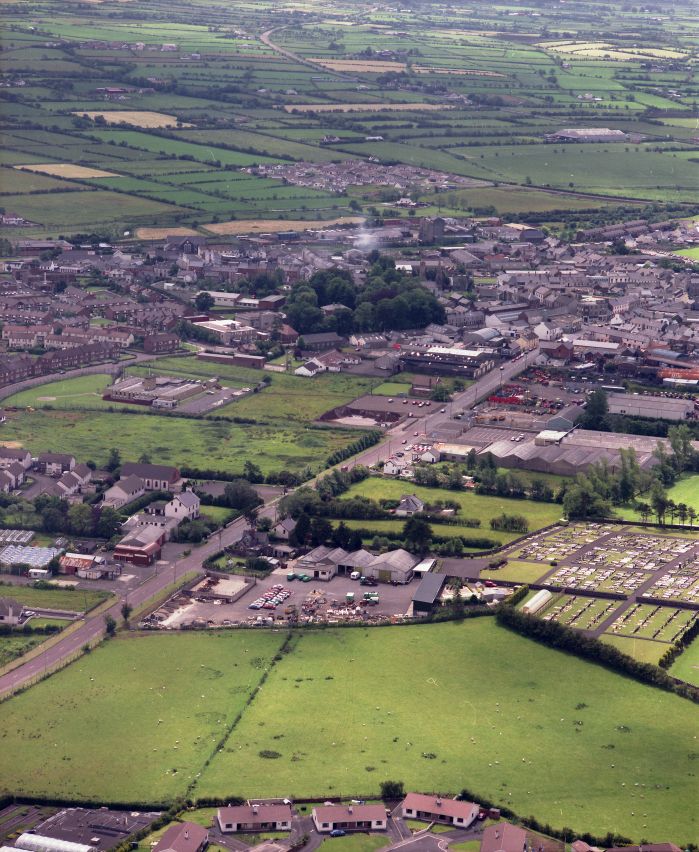
IR01-04
1990-06-20: Mamiya RB67, 180mm Sekor, Vericolor III Professional Type S; Cessna 152 G-BPLW
Ballymoney, looking south. Running in from the bottom left-hand corner is the Dervock Road (which some Post Office clerk re-named Knock Road when PostCodes were introduced). It becomes Market Street at some point nearer the junction with Victoria Street / Charles Street. Below and left of centre is the Free Presbyterian Church and hall. Near bottom right is the cemetery. To the right of the central clump of trees is St Patrick's Church of Ireland. Curving out of the picture at top centre is the Rasharkin Road.
If you can add to the information here, please let me know.
|
This page last updated 2021-06-07 14:04.
I try to make this page as accessible as possible,
by adhering to HTML 4 standards.
|

|

|
|
I welcome comments on this website. However, because of the
amount of spam it attracts, I no longer post a direct e-mail
address on any page. Instead, please
click here to contact me.
You will have to confirm that you are human before the message
will be sent on to me.
|