|
|
Aerial photos: Gloucestershire (DSCN0829)
|
|
|
|
|
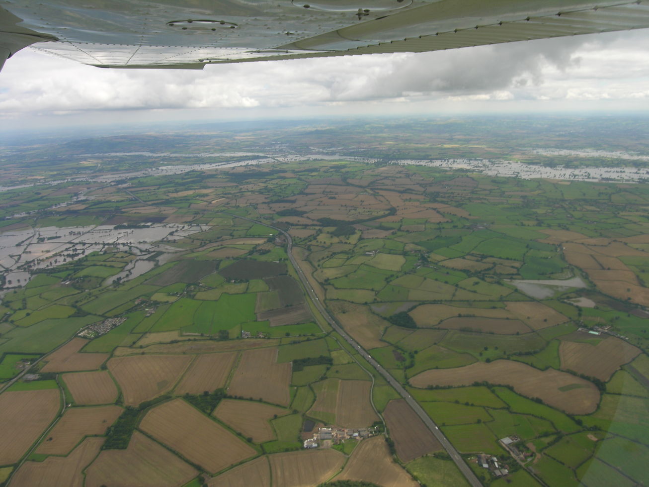
DSCN0829
2007-07-24: Nikon Coolpix 8400; Cessna 152 G-BFEK
Gloucestershire floods 2007. Looking out to starboard (east) along the M50 towards the confluence of the Severn and Avon at Tewkesbury. Beyond the Avon at left of centre is Bredon Hill. The flooded area at the left of the picture is Longdon Marsh, with Sledge Green in front of it.
If you can add to the information here, please let me know.
|
|
|
next picture page |
| Return to Rowland's home page |
| This page last updated 2021-06-07 14:04. I try to make this page as accessible as possible, by adhering to HTML 4 standards. |
|
|
| I welcome comments on this website. However, because of the amount of spam it attracts, I no longer post a direct e-mail address on any page. Instead, please click here to contact me. You will have to confirm that you are human before the message will be sent on to me. | ||