|
|
Aerial photos: Gloucestershire (DSCN0821)
|
|
|
|
|
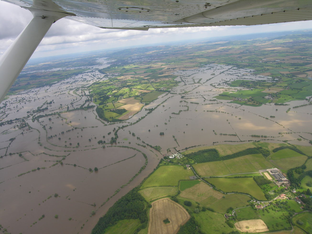
DSCN0821
2007-07-24: Nikon Coolpix 8400; Cessna 152 G-BFEK
Gloucestershire floods 2007. Looking out to starboard (north) above Wainlode Hill (lower centre) towards Bredon Hill (upper centre). The sinuous course of the Severn is visible only by the lines of vegetation along its banks. The diagonal line of trees in the water across the centre of the picture marks the course of the disused Coombe Hill Canal, from the Severn at lower left to Coombe Hill upper right. Another line of trees across the flooded area at the left marks the B4213 road across Haw Bridge. In the distance is the confluence of the Severn and the Avon.
If you can add to the information here, please let me know.
|
|
|
next picture page |
| Return to Rowland's home page |
| This page last updated 2021-06-07 14:04. I try to make this page as accessible as possible, by adhering to HTML 4 standards. |
|
|
| I welcome comments on this website. However, because of the amount of spam it attracts, I no longer post a direct e-mail address on any page. Instead, please click here to contact me. You will have to confirm that you are human before the message will be sent on to me. | ||