 |
Aerial photos: Gloucestershire (IR54-07)

|
 |
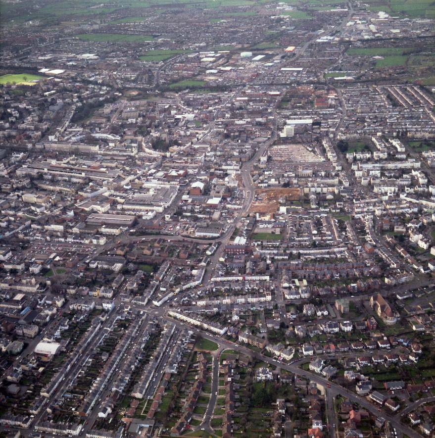
IR54-07
1998-03-04: Rolleiflex 3.5 MX-EVS, Vericolor 160 Professional; Cessna 152 Aerobat G-BIMT
Northern central Cheltenham looking west. The High Street runs in from the lower left side, becomes the Tewkesbury Road and goes out towards top right. Near the centre of the left edge is the Regent Arcade with its arched roof looking rather like an enormous brown log with a white end laid on top of the building. About 3/4 way up the left edge is the bright green area of the Cheltenham Ladies College sports centre. Immediately beyond that, the dark greenish line running across the picture is the old Honeybourne railway line, now a cycle-track and footpath. Beyond it a similar feature, converging with it to the left, marks the working railway line leaving the town to the north. In the top right corner is a large cluster of retail and industrial units. Just right of centre, the brownish area is the development site on the corner of Winchcombe Street and Fairview Road. Beyond that the Portland Street and North Place car parks are visible. Running in from the bottom right corner of the picture is Hewlett Road.
If you can add to the information here, please let me know.
|
This page last updated 2021-06-07 14:04.
I try to make this page as accessible as possible,
by adhering to HTML 4 standards.
|

|

|
|
I welcome comments on this website. However, because of the
amount of spam it attracts, I no longer post a direct e-mail
address on any page. Instead, please
click here to contact me.
You will have to confirm that you are human before the message
will be sent on to me.
|